
Contour & Detail Survey Services
CitiSurv specialises in delivering comprehensive Contour and Detail Survey solutions tailored to meet your project’s specific needs. Our expert team is equipped to provide detailed insights into your land’s topography, ensuring a solid foundation for your future development plans.
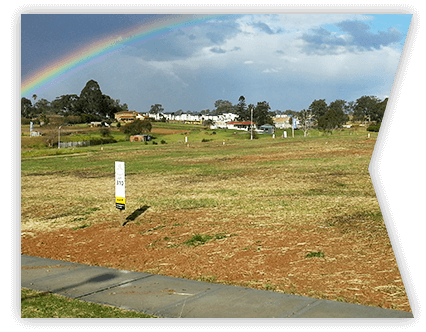
What is a Contour & Detail Survey?
A Contour and Detail Survey, often conducted by licensed land surveyors, is an essential process in the field of civil engineering and land development that maps the existing conditions of a land parcel. This detailed survey is essential for anyone looking to understand the nuances of their property, be it for residential, commercial, or industrial development.
By meticulously charting the contour lines, this survey reveals the natural and man-made features of the site, offering a clear picture of the terrain’s elevations and depressions.
Purposes of a contour and detail survey:
- Contour Mapping: It involves mapping the contours of the land, which are imaginary lines that connect points of equal elevation. Contours provide a three-dimensional perspective of the land on a two-dimensional map, allowing for the visualisation of the terrain’s shape, slopes, and elevations. This is crucial for understanding the natural flow of water on the site, potential flood areas, and the general topography.
- Detail Collection: Along with the topographical information, a Detail Survey also collects information about natural features (such as trees, rocks, and water bodies) and man-made elements (including buildings, fences, and utilities) on the site. This comprehensive data collection is vital for planning and development purposes, ensuring that designs are in harmony with the existing landscape and infrastructure.
This type of survey is commonly used in the planning and design phase of construction projects, landscaping, and infrastructure development. It provides architects, engineers, and planners with the necessary data to make informed decisions regarding site layout, building orientation, drainage design, and other aspects of land development to ensure safety, compliance with regulations, and optimal use of the terrain.
Surveys are a Foundation for Project Planning & Design
Our Contour Survey services are designed to provide an accurate representation of your land’s topography. By capturing the variances in land elevation, our contour surveys lay the groundwork for informed decision-making in your project’s planning and design phases.
Our Detail Survey services go a step further by identifying all existing structures, visible services, and significant features on the subject property. From trees and buildings to fences and utilities, every element is precisely documented to aid in your project’s design and construction phases.
Why Choose CitiSurv for Your Surveying Needs?
- Expertise: With years of experience under our belt, we bring a depth of knowledge in engineering surveying, particularly in Contour Surveys / Level Surveys / Detail Surveys.
- Precision: Our commitment to accuracy is unwavering. We employ the latest in surveying technology and adhere strictly to the Australian Height Datum (AHD) and Australian Standards.
- Comprehensive Services: Our surveys are detailed and tailored to your specific needs, covering everything from land topography to underground services.
- Client-Centric Approach: We guide you through every step, from initial consultations to obtaining council approvals, ensuring your project’s success.
CitiSurv’s approach to surveying extends beyond the traditional boundaries. Our surveys include comprehensive assessments that are crucial for local council submissions and development applications. Whether it’s a boundary survey to define your property lines or a site survey to prepare for land development, our team ensures every detail is captured with precision
Trusted Partner for Development Projects
At CitiSurv, we view ourselves as more than just service providers. We are your partners in development, committed to supporting your project from concept to completion. Our expertise in feature and level survey work ensures that every aspect of your land’s topography and existing features is accounted for, making us an invaluable part of your project team.
Our service areas include Sydney, Central Coast, Newcastle, Hunter Valley, Southern Highlands and Wollongong.
Contour & Detail Survey Tools & Technology
Leveraging the latest technology and methodologies, our team is at the forefront of surveying services. From initial survey plans to final reports, our focus is on delivering high-quality, actionable data that drives your project forward.
Ready To Start Your Development Journey
CitiSurv’s Contour and Detail Survey services are meticulously designed to support your project’s journey from the ground up. With our deep understanding of local council requirements, topographical surveys, and the intricacies of land development, we provide the essential data and insights required for informed decision-making and successful project outcomes. Trust in our expert team to deliver precision, professionalism, and personalised service that stands out in the land surveying industry. Let CitiSurv be the foundation upon which your next project thrives. Reach out to us to explore how our land surveying solutions can bring your vision to life with unparalleled accuracy and expertise.
Frequently Asked Questions
Why do you need a contour & detail survey?
A Contour and Detail Survey is needed to provide a detailed understanding of a site’s topography and existing features, essential for informed planning and design of construction projects, ensuring regulatory compliance, efficient land use, and environmental preservation.
What is the difference between a contour survey, site survey, feature survey, topography survey, AHD or level survey?
A Contour Survey provides a detailed depiction of the terrain’s elevation changes through contour lines, offering insights into the land’s slopes, hills, and valleys, essential for construction and landscaping plans while Site Survey involves a comprehensive assessment of a property, noting its dimensions, boundaries, orientation, and existing structures, crucial for initial planning and legal documentation.